
A Cape Cod home received a $3.85 million mortgage in November 2021 before coastal erosion led to its demolition in 2025, according to reporting published by Realtor.com on 21 July 2026.
The $3.85 million mortgage is now the subject of an unresolved federal dispute. The more reusable property question is why an appraisal, loan approval, flood map and shoreline-change record can all be valid documents while answering different questions about the same home.
Why did the Wellfleet home still hold value as its bluff retreated?
The Cape Cod home combined a Wellfleet bayfront setting with a rapidly retreating bluff. Its $5.5 million 2021 sale shows that the property retained a high transaction price despite the documented retreat, although public sources do not isolate how buyers valued the waterfront setting, views or local supply.
The central conflict is not that the property had no value. Market participants could price immediate use, location and scarcity without agreeing on the land’s usable horizon. A shorter horizon can reduce value without making value zero, especially when no single document supplies a certain demolition date.
Realtor.com reports that John G. Bonomi Jr. paid $5.5 million in November 2021 and financed $3.85 million. The report says the property had already been described as endangered, while prior owners had sought permission for a 241-foot stone revetment, a shore-protection structure, in 2018.
Present value was measured at the transaction date, while physical longevity depended on a separate erosion timeline. A buyer could still prize the waterfront experience, and comparable transactions could still support a high current value, even when a separate coastal analysis described a shortening site horizon.
How can an appraisal value a coastal home without predicting its lifespan?
An appraisal estimates a property’s market value at an effective date from its characteristics, market evidence and comparable sales. For the Cape Cod home, that valuation question differed from the bluff’s remaining life.
Fannie Mae’s environmental-hazard guidance explains the general mechanism. When comparable market data measures a hazard’s effect, the appraisal reflects any adverse effect on value and marketability or records that the market shows no buyer resistance.
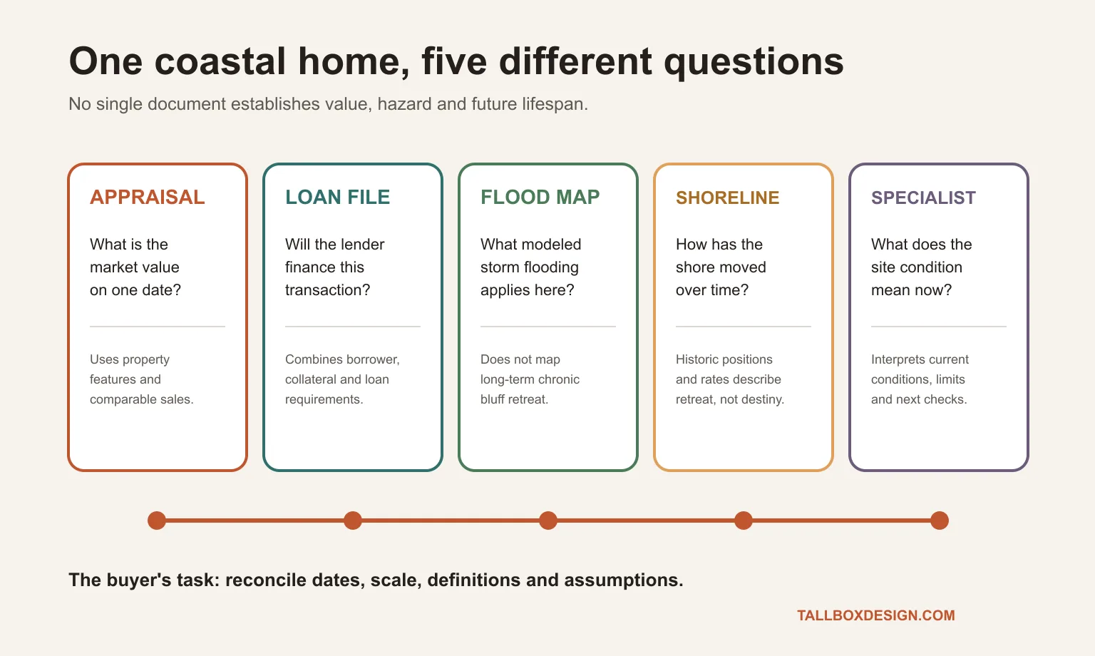
Fannie Mae says its forms address remaining economic life, but appraisers are not required to report that figure. Related property deficiencies still belong in the appraisal’s condition analysis, and the lender decides whether additional inspections are needed.
The reported $3.85 million loan was above conforming limits and may not have followed Fannie Mae rules. Fannie Mae’s environmental-hazard guidance is useful as a public example of appraisal scope, not proof of what governed the private Wellfleet loan file.
The Consumer Financial Protection Bureau separates an appraisal from a home inspection and says buyers generally need both. For the Wellfleet case, the document stack therefore adds qualified review of land condition, permitting history and protective-work options.
Why do flood maps and shoreline-change maps measure different coastal hazards?
Flood maps model defined storm and water exposure, while shoreline-change records measure long-term land movement. At the Cape Cod home, the decisive process was bluff retreat, which FEMA coastal flood analysis excludes from its long-term erosion scope.
Flood mapping informs insurance requirements, building standards and modeled water exposure. Shoreline retreat adds a land-loss timeline that may affect setbacks, access, protective-work options and the feasible location of a structure. Buyers need both records because one cannot substitute for the other.
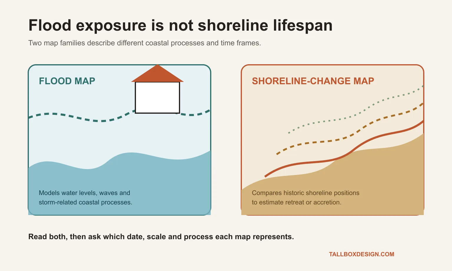
Massachusetts shoreline-change mapping compares historic shoreline positions and calculates erosion or accretion rates. Near the property, the state viewer placed long-term erosion around 2.5 to 3 feet a year, while the 2024 Wellfleet report described a faster recent rate of 3.8 to 5.6 feet.
A historic shoreline-retreat rate remains a measured history, not a countdown clock. Because storms, groundwater, bluff material, beach geometry and protective-work constraints can make short-term retreat diverge from long-term averages, a buyer should obtain a current assessment from a qualified coastal professional.
Which property records belong beside a waterfront listing?
A waterfront listing should sit beside the appraisal, shoreline history, permit record and current-site review. At the Cape Cod home, the visible setting appeared in the listing while the decisive erosion history remained in separate local and technical records.
Tallbox’s guide to visible listing context and address-specific records explains the boundary. Photographs and site-aware plans reveal grade, access and surroundings, while maps, surveys and qualified opinions address property-specific risk.
Read together, the appraisal, flood map, shoreline record and professional review frame a waterfront-home decision without allowing one record to stand in for the others.
What does mortgage approval confirm about a coastal property’s future?
Mortgage approval confirms that a lender accepted the borrower, collateral and terms under that lender’s underwriting process. The Cape Cod home’s loan funded the 2021 transaction, but it did not stop the bluff from retreating or provide a general warranty for the property’s future.
Bonomi’s complaint alleges that JPMorganChase knew or avoided the property’s collateral problem and asks the court to void the mortgage. JPMorganChase denies the allegations and says it acted in good faith and according to reasonable commercial standards.
The federal case has not produced a final ruling on Bonomi’s allegations. The public record does not include the private appraisals, engineering correspondence or complete loan file needed to reconstruct the lender’s approval decision or assign legal responsibility.
What should a coastal buyer verify before relying on an appraisal?
Before relying on an appraisal, a coastal buyer should compare the record’s date, geographic scale, covered hazard, assumptions and need for specialist review. The Cape Cod home shows why one valuation figure cannot answer all five questions.
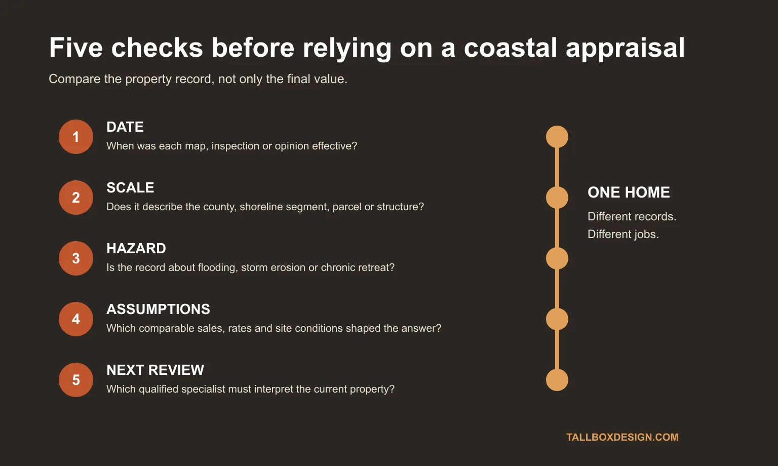
- Compare the appraisal’s effective date with each map, permit, survey and site inspection.
- Separate county-level or shoreline-segment data from parcel and structure observations.
- Identify whether each record covers flooding, storm erosion, chronic retreat, drainage or bluff stability.
- Ask which comparable sales, erosion periods and current dimensions support the conclusion.
- Identify the qualified local professional needed to interpret the current property and the proposed decision.
The Wellfleet story does not show that every exposed coastal property lacks value or finance. Instead, the case illustrates why value, financing and physical longevity require separate evidence and a decision that acknowledges each document’s limits.
Sources and citations
- Realtor.com. How a disappearing Cape Cod home qualified for a $3.85m mortgage. Published 21 July 2026. Accessed 21 July 2026.
- Associated Press. A multimillion-dollar home is close to falling into Cape Cod Bay. Published 5 February 2025. Accessed 21 July 2026.
- Associated Press. Luxury home at risk of tumbling into Cape Cod Bay is demolished. Published 25 February 2025. Accessed 21 July 2026.
- Fannie Mae. Environmental Hazards Appraisal Requirements. Updated 4 June 2025. Accessed 21 July 2026.
- FEMA. Frequently Asked Questions About Coastal Analysis. Accessed 21 July 2026.
- Massachusetts Office of Coastal Zone Management. Massachusetts Shoreline Change Project. Accessed 21 July 2026.
- Consumer Financial Protection Bureau. Schedule a home inspection. Updated 2025. Accessed 21 July 2026.